Lost in the Jungle: Finding Your Way Back and Getting Help
What to do when a rainforest trail disappears, your group moves out of sight, or heavy rain cuts off the way back—with or without equipment.
Short answer
Key takeaways
- Separate losing the route from being unable to use it: a familiar crossing can become impassable after rain.
- Without equipment, recover an identifiable short detour if you can; otherwise organize protection and signalling at one position.
- Use trail signs, your own route information, and current conditions together; an exit shown on a screen does not establish a walkable connection.
- If separated from a tour, make your departure point and last contact with the group part of the help request.
- Set up a waiting position while you can inspect the ground, keeping weather protection and visibility to people in the same plan.
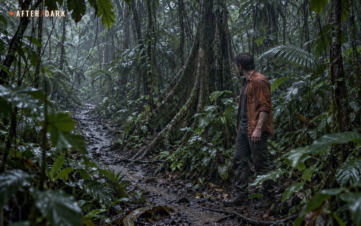
In dense rainforest, losing the route can begin with an ordinary interruption: stepping aside for a photograph, passing a fallen tree, or losing sight of the person ahead. Heavy rain adds a different problem: the trail may still be recognizable while the way back is no longer usable.
This guide covers both situations on a rainforest walk, including an unplanned delay without a pack or working phone. The same decisions matter when a longer communications outage removes the support you expected to have.
Lost in the Jungle With No Equipment
You left the main path, and now broad leaves and trunks hide the way you came. Your phone and bag are elsewhere, or you never brought them. Start with the place around you, while the last movements are still fresh in your memory.
Stop and turn to look behind you. Recall the specific reason you changed direction: passing one side of a root, walking around a fallen branch, or stepping away from the group. Try to identify that exact feature and the approach to it. The Forest Service's stop-and-observe guidance is useful here because it interrupts the impulse to keep searching while moving.
- If the way you just came is identifiable and safe, retrace that short connection to the path. At the path, confirm where you rejoined it and the route to a known destination before continuing.
- If several gaps in the vegetation could be the way back, keep your position. Walking through each gap in turn adds more uncertain turns to remember.
- If you can hear companions, call your name, say that you have lost the path, then pause for a reply. Ask them to stop and help establish where you are. Keep the group in one conversation instead of trying to intercept moving voices through the undergrowth.
For example, a visitor steps behind a large buttress root to take a photograph. The root and the small patch of ground they crossed are still visible; returning over that same ground may restore the trail connection. If they have already rounded several similar trunks and cannot identify the starting one, the original short detour no longer provides a reliable return.
If You Are Alone and Have Already Lost the Route
You have been walking for some time, cannot recognize the way back, and have no phone, map, or pack. There may be no trail or companions within sight. Organize the next actions around your current position, using the basic approach to waiting without a phone or reception:
- Establish one stopping point. Note a distinctive feature immediately beside you, such as the shape of a trunk or exposed root. Use it to keep track of your position while checking the nearby ground; it does not tell you where the exit is.
- Choose the nearest workable protection. Look for firm ground with less direct rain and wind, outside a drainage hollow and away from damaged trees. If your current spot is unsafe, move to nearby safer ground. Keep the connection to your stopping point identifiable wherever conditions allow.
- Make yourself noticeable and listen. Call at intervals, with pauses for replies, and whenever you hear people. Wave if someone comes into view. Keep the clothing you need on your body; a signal should not leave you less protected.
- Use any contact to start getting help. If someone reaches you, explain that you are lost and need assistance. Give your entry point and the last place you recognized; ask them to relay your situation if they can reach the park or emergency service.
If nobody knows your itinerary, a search may not have started. Until contact or reliable route information changes the situation, use the waiting and morning checks below to maintain your position and decide the next step.
Choose the task that matches what happened, rather than treating every delay as a navigation problem.
| Situation now | First useful action | What the next step depends on |
|---|---|---|
| Off the path, no equipment | Identify the point where you left it and the ground you just crossed | A recognizable, safe connection back |
| Alone, no equipment, route already unrecognizable | Establish one stopping point, use nearby protection, and signal | Contact with another person or reliable new route information |
| Trail continues, but you do not know its destination | Check a sign, trail map, or your own route record from the current position | Evidence that this is the route you intended |
| Known return blocked by rising water or damage | Stop before the obstruction and use a safer position on your side | Local advice or a confirmed usable alternative |
| Separated from a guided group | Call, stop uncertain pursuit, and contact the guide if possible | A shared location and clear instructions |
| Phone works but has no service | Use stored route information and check available emergency communication | What the device can actually display or transmit |
| Unable to leave before dark | Arrange protection, visibility, and contact while you can see the ground | Available clothing, shelter, light, and communication |
Recover the Trail Through the Vegetation
A direction toward the entrance is useful only when connected to a route you can follow. Dense vegetation makes the distinction especially important: the car park can be close on a map while the ground between you and it is a steep slope or a stream channel.
Look for a connected route
Read any sign from where you are and check its destination, route name, and arrow. If the park uses numbered markers, report the number exactly. Use the marking system for that particular walk; a worn gap or a piece of ribbon by itself does not establish a public route. Official guidance is to follow trail markers and designated tracks, since apparent shortcuts can end without a usable connection.
When a known return is possible, work between recognizable points. Reach the next confirmed bend or junction, then check the following section before committing to it. Keep companions close enough that a pause at an obstacle does not separate the group again. Progress means restoring a connection to a known route and destination—not simply covering distance.
Suppose a sign identifies the visitor-centre route, but a narrow opening leads more directly toward where you think the building stands. The sign gives you information about a route. The opening gives you information only about the vegetation immediately ahead. They are not equivalent evidence.
When an obstacle hides the continuation
A fallen crown can obscure the trail beyond it. Look from the known path for an official diversion or an unmistakable continuation. If you cannot establish a safe connection, stop before making a detour that loses the approach you recognize. Finding the trail on the far side is still an unresolved task.
Do not use hanging vegetation as a climbing aid to solve the obstruction. Vines can pull free or bring down branches; Daintree's rainforest walking guidance specifically warns against using them to haul yourself up steep sections. It also identifies slippery trails in wet weather and plants that can catch clothing or sting on contact. Keep movement on the established route where you can see your footing, rather than reaching blindly into vegetation for support.
When Rain Cuts Off a Route You Know
You may know exactly where the exit is and still be unable to reach it by the route you used earlier. Treat this as a change in access: more certainty about your location will not restore a flooded crossing or a damaged bridge.
At a stream that has risen across the path, stop on your side. Do not attempt to cross flooded waterways. Wet rocks, waterfall edges, and steep drops also require care, so searching along the bank for an improvised crossing can create another problem. A mapped line through the stream describes the route, not its present condition.
Use the known approach to move back to nearby firm ground outside the channel and away from unstable edges. If water is threatening your position, leave that position promptly for safer ground; do not wait at the crossing itself to watch it. Keep your connection to the established trail wherever possible.
When you contact help, describe the obstruction and which side you are on. “On the outward side of the crossing, away from the entrance” is more useful than guessing east or west. Give the trail name, last marker, and direction you had been traveling. If you have coordinates, add them to that description.
Consider this example: you recognize the crossing and can see the return trail on the opposite bank. Your map also shows a second route joining farther ahead, but you have not walked it and do not know its condition. That second line is information to discuss with a ranger, not yet an established alternative. If a signed, open diversion is available, check its destination and whether you can follow it under the current conditions.
Rain stopping at your location does not establish that the crossing is usable again: rainforest river levels can change rapidly and without warning. Follow local closure information and responders' instructions, and use the waiting arrangements below if the return remains blocked. The decision depends on this crossing's conditions, rather than a fixed waiting time.
Use Your Equipment to Resolve the Missing Information
Keep each tool tied to a question. This avoids spending the remaining daylight moving between apps while the actual problem—a missing turn or a blocked section—stays unresolved.
With a phone, focus on the disputed part of the walk. Find the last confirmed crossing or junction on your saved map or recorded track, then compare the next section with the ground. For example, if the recorded walk crossed a stream but you are now following its bank, investigate that mismatch from your current position before continuing. A saved photograph of the entrance board can supply the route name even when no detailed map is available.
A location fix can help describe where you are. Check it against recognizable features before using it to choose a path. Trees can obstruct GPS signals, and mapping errors are a separate limitation. If the screen places you on the other side of a ravine, report the uncertainty rather than trying to make the ground match the dot.
With a map and familiar compass, check the connection around the obstacle. Compare the trail's direction, slopes, and crossings; establish the next point you expect to reach. Our woodland guide explains locating yourself with a map and compass in detail. In this situation, pay particular attention to whether a proposed alternative would require another stream crossing or leave the marked route.
Keep electronics out of direct rain when using them, and use a waterproof pouch if you carry one. Protecting the phone from water and understanding its communication limits are part of keeping it useful. Sleep the screen between checks; after reaching responders, keep the phone available for their messages and calls. For a future walk, test the offline trail maps before leaving reception.
Reconnect With Your Group or Get a Message Out
If a guide was leading you, contact them with your last shared stop and explain that you are separated. Mention whether you stayed on the route or stepped off it. A guide who knows the itinerary has information that a vague description such as “near the waterfall” leaves out.
With only your voice, call clearly and listen between calls. If someone answers, establish who they are and whether they can actually see you. Hearing a reply through the vegetation does not identify the intervening ground. Use the exchange to coordinate a meeting on the known path rather than sending both sides searching independently.
Make the report specific to this walk
If you cannot return safely, contact the local emergency service or official park emergency contact. Do not postpone that call while trying to produce perfect coordinates. The essential location and equipment details can be given in ordinary language.
For a rainforest visit, organize the facts you have:
- The park, entry point, named trail, and tour operator or guide, if applicable.
- Where you last saw the group or recognized the route, including a marker or junction name.
- Whether you are off-trail or still on a known trail with a blocked return.
- Number of people, clothing colours, available light and shelter, and any constraint on movement.
An example report: “I started at the south visitor entrance with the afternoon walking group. We last stopped at the numbered bridge. I am still on the trail beyond it, but the crossing is covered by water. I have an orange shirt, one phone, and no bag.” A name copied from a sign or booking is preferable to inventing a translation of a place name.
Follow the recipient's directions about where to wait and whether to move. If you must leave a position because it becomes immediately unsafe, report the change as soon as possible. Do not leave a location already supplied to responders merely to look for a more convenient pickup spot.
If you cannot reach anyone
A guide's number, an emergency calling screen, and a sent-message icon are not confirmation that somebody knows you need help. Use an available satellite emergency function if your device supports it, following its instructions; otherwise concentrate on the communication opportunities actually present. Keep the phone protected and within reach for another opportunity or a callback.
If hikers reach you, explain that you need help. Ask them to relay your location and circumstances to the park or emergency service, and agree on where you will remain. If they can guide you back along a confirmed safe route, explain any obstruction you have already encountered before deciding together how to proceed.
A trusted contact with your route and expected return can raise an alarm when you are overdue. If you reach that person before reaching the park, explicitly ask them to notify the appropriate local service and pass on the details above. Confirm what they have agreed to do so a brief conversation does not end with each of you expecting the other to arrange help.
Make a Waiting Position Work Through a Wet Night
Use the remaining light to choose and arrange your position. The useful result is a place where you can wait, be located, and keep your available resources together. It need not resemble a campsite.
Check the ground and overhead cover
Look at where runoff is moving now. Choose nearby firm ground outside a watercourse or drainage hollow, without stepping onto an exposed edge. Check overhead for dead or leaning trees and hanging broken branches. A roof of foliage is less useful if the space beneath it has those hazards.
Where conditions allow, choose protection within sight of your stopping point and any nearby trail. If you are sheltering beside the route, face the direction from which people could approach. A more enclosed spot farther through the vegetation may hide you from the very path you want someone to use to reach you.
With no shelter equipment: compare the few safe positions immediately available for less direct rain and wind. Use the least wet stable surface you can reach without losing your location. Keep your clothing available for protection; close a jacket or use its hood if you are wearing one. Do not turn the search for perfect dryness into another journey through unfamiliar ground. If companions are with you, settle together and agree that nobody leaves unnoticed.
With a pack: put on the weather layer you brought and use your emergency shelter, bivy, or tent as intended. Use a carried mat for the wet ground. Keep the phone, light, drinking water, and signalling items reachable from the protected position. Avoid unpacking everything onto wet leaf litter: take out what you need and close the bag again.
Keep people able to notice you
Where leaves block a view from above, concentrate on also being noticeable from the route. A bright pack cover or shelter can mark your position without taking needed clothing off your body. Call when you hear people, and pause so that their response is not lost beneath your own voice.
If you have a whistle, repeat groups of three blasts with listening pauses. Keep a light available for essential tasks and signalling after dark. Neither requires walking away from your position to search for a clearing.
Account for water and the next change in conditions
Check the water and food you actually have before unpacking other items. Keep your drinking water closed and within reach. If the supply is running out, include that fact in the help request so it is part of the waiting plan.
For someone with a bottle, collecting and treating water is a different task from someone with no container at all. Our guide to finding and collecting water in the wild covers both starting points; treating collected water explains the next step. Keep any movement for water consistent with the location already reported and the conditions around you. Rainfall does not make a swollen stream a suitable collection point.
As rain, visibility, or light changes, check whether runoff is approaching your spot and whether your shelter is still usable. Keep any agreed communication arrangements.
What to Check When Daylight Returns
Before packing up, identify what has changed since you stopped. Apply the same route-confidence check with the information now available:
- Check any existing arrangements for help. If someone has your location and expects you to remain there, follow those instructions. Update them if the position has become unsafe.
- Look for newly visible evidence from your position. Can you now identify a sign, built steps, or a distinctive bend that matches your earlier route? Name the feature and explain how it connects to where you came from. A brighter gap between trees alone does not answer that question.
- Check the intervening ground. Can you reach that confirmed feature along a recognizable, usable connection? Look for runoff, damage, or an obstacle that would force another uncertain detour. Keep this observation local; do not turn it into exploratory walks in several directions.
- Assess the onward journey. Establish the destination and route beyond that feature, the current weather and light, and whether you can manage the walk with your remaining resources. Account for companions if present.
For example, daylight might reveal the same marked steps you left before taking a wrong turn. If the short approach is identifiable and unobstructed, that is useful new evidence for returning. Seeing only a strip of distant sky gives you no comparable connection. If the checks still leave the route uncertain, continue protecting your position and signalling; morning alone is not a reason to abandon it.
Zombie Scenario: The Detour Around a Fallen Palm
Fictional scenario
During a prolonged outage, a traveler takes a marked rainforest path toward a staffed supply point. A fallen palm hides part of the path. While trying to pass around its roots, the traveler enters a gap between broad leaves and realizes that the established trail has disappeared.
The traveler stops before rounding another trunk. Looking back, they can still identify the root they just passed and the last trail marker beyond it. The short stretch back is recognizable and clear, so they retrace it to the marker.
From there, a signed diversion is visible on the other side of the fallen palm. They check its named destination and the ground connecting it to the path before continuing. Returning to the last confirmed point has restored information that the apparent gap in the vegetation never supplied.
Frequently Asked
Can I use the advertised walking time to decide whether I can get out before dark?
Should I keep looking for the trail after dark if I have a headlamp?
Can I make an emergency call when my phone says SOS or emergency calls only?
What should I do if I hear or see a helicopter above the canopy?
What if rising water makes me leave the location I already reported?
Who should I tell once I have found my way out?
Sources
- US Forest Service — If You Get Lost
- Queensland Parks and Wildlife Service — Walk With Care
- Queensland Parks and Wildlife Service — Visiting Daintree Safely
- Queensland Parks and Wildlife Service — Visiting Lamington Safely
- GPS.gov — GPS Accuracy
- AdventureSmart — Communication and Signalling
- National Park Service — Outdoor Emergency Plan
- AdventureSmart — The Three Ts
- US Forest Service — Recreating Outdoors: Hazard Trees
- National Park Service — Ten Essentials
- Queensland Government — Ten Safety Tips for Bushwalking and Hiking
- Australian Government — How to Call Triple Zero (000)
Related guides
What to Do If You Get Lost in the Woods
A practical plan for losing your way in a forest: recover a known route when you can, and make yourself easier to find when you cannot.
How to Find and Collect Fresh Water in the Wild
Locate reachable water, work with the equipment you actually have, and collect from streams, springs, rock pools, or rainfall.
How to Make Water Safe to Drink in the Wild
Use a pot and heat, a filter and disinfectant, or sunlight to turn collected fresh water into a drinking supply. Follow the steps for what you have.